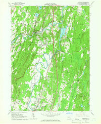
1964 Map of Rosendale
USGS Topo · Published 1966About this map
Rondout Creek and the Wallkill River converge in this mid-1960s landscape, illustrating a complex network of historical transportation and industry in Ulster County. The map documents the persistent infrastructure of the New York Central Railroad alongside an Old Railroad Grade, tracing the path of commerce through settlements like Rosendale and High Falls. The industrial character of the era is evident in the numerous quarries, mines, and sandpits dotting the terrain, particularly near Binnewater and Tillson.
Find a feature on this map
63 named features on this map. Tap any name to fly to it.
Don’t see what you’re looking for? This feature index may not catch every label — zoom into the map to look around manually.
Map Details
Editions of this 1964 Rosendale Map
Other maps of this area

1893 · Poughkeepsie
USGS Topo · 1:62,500

1894 · Poughkeepsie
USGS Topo · 1:62,500

1898 · Rhinebeck
USGS Topo · 1:62,500

1901 · Rosendale
USGS Topo · 1:62,500

1903 · Poughkeepsie
USGS Topo · 1:62,500

1903 · Newburg
USGS Topo · 1:62,500

1903 · Rosendale
USGS Topo · 1:62,500

1934 · Rhinebeck
USGS Topo · 1:48,000

1936 · Poughkeepsie
USGS Topo · 1:48,000

1939 · Rhinebeck
USGS Topo · 1:62,500