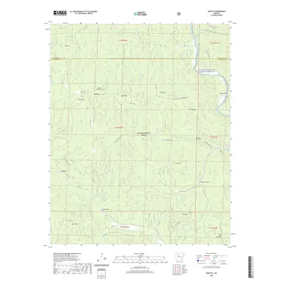
2020 Map of Rosetta
USGS Topo · Published 2020About this map
Rosetta and Garber sit within the high ridges of the Boston Mountains in this modern topographic record of northern Johnson County. The landscape is defined by the deep incisions of Little Piney Creek and the Big Piney Creek Wild and Scenic River-6, with prominent elevations such as Rich Knob, Ozone Mtn, and Pilot Rock Mountain rising above the timbered terrain. Much of the area is protected as part of the Ozark National Forest, where the Ozark Highlands Trail winds across the hills and hollows like Childers Hollow and Turkey Hollow. For those tracing local history or family ties, the map identifies the Rosetta Cem and Union Cem, alongside established county routes like Co RD 5671 and Co RD 58 that connect these remote mountain communities.
Find a feature on this map
56 named features on this map. Tap any name to fly to it.
Don’t see what you’re looking for? This feature index may not catch every label — zoom into the map to look around manually.
Map Details
Editions of this 2020 Rosetta Map
This is the sole edition of this map. No revisions or reprints were ever made.
Other maps of this area

1889 · Treat
USGS Topo · 1:62,500

1889 · Ozone
USGS Topo · 1:62,500

1932 · Treat
USGS Topo · 1:62,500

1933 · Mt Judea
USGS Topo · 1:62,500

1934 · Treat
USGS Topo · 1:62,500

1934 · Ozone
USGS Topo · 1:62,500

1936 · Ozone
USGS Topo · 1:62,500

1940 · Mt Judea
USGS Topo · 1:62,500

1956 · Russellville
USGS Topo · 1:250,000

1964 · Russellville
USGS Topo · 1:250,000