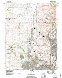
1992 Map of Roseville
USGS Topo · Published 1997About this map
The Roseville and Rocklin corridor appears during a period of significant suburban expansion, where established ranching lands meet growing municipal boundaries. Large agricultural holdings like the W F Fiddyment Ranch and R F Fiddyment Ranch still occupy the western plains, while the eastern edge is defined by the Southern Pacific railroad line and the rising terrain of Telegraph Hill. The map documents the city's civic infrastructure, including the County Fairground, Roseville Cemetery, and the Diamond Oaks Municipal Golf Course. Water management is central to this landscape, with complex drainage systems like Ingram Slough and Pleasant Grove Creek winding through the developing residential and industrial zones, including the notable Industrial Waste Ponds located north of the city center.
Find a feature on this map
45 named features on this map. Tap any name to fly to it.
Don’t see what you’re looking for? This feature index may not catch every label — zoom into the map to look around manually.
Map Details
Editions of this 1992 Roseville Map
This is the sole edition of this map. No revisions or reprints were ever made.
Other maps of this area

1891 · Sacramento
USGS Topo · 1:125,000

1892 · Sacramento
USGS Topo · 1:125,000

1893 · Sacramento
USGS Topo · 1:125,000

1902 · Fairoaks
USGS Topo · 1:62,500

1910 · Sheridan
USGS Topo · 1:31,680

1910 · Lincoln
USGS Topo · 1:31,680

1910 · Roseville
USGS Topo · 1:31,680

1910 · Pleasant Grove
USGS Topo · 1:31,680

1911 · Arcade
USGS Topo · 1:31,680

1911 · Antelope
USGS Topo · 1:31,680