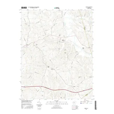
2016 Map of Rosine
USGS Topo · Published 2016About this map
Horse Branch and the village of Rosine serve as the primary hubs in this part of Ohio County, where the landscape is defined by the winding paths of Caney Creek and its many tributaries. The area is dense with family and community heritage, evidenced by numerous burial sites including Baizetown Cem, Arnold Ridge Cem, and Leach Cem that dot the ridges and hollows. Transport in the region ranges from the modern corridor of the Western Kentucky Pkwy to historical routes like Wilderness Rd and Uncle Pen Ln. Terrain features such as Wildcat Knob and Hickory Knob rise above the stream valleys of Muddy Cr and McGrady Cr. Small settlements like Arnold, Renfrow, and the uniquely named Dogwalk are connected by a network of local roads, reflecting a deeply rooted rural Kentucky settlement pattern.
Find a feature on this map
88 named features on this map. Tap any name to fly to it.
Don’t see what you’re looking for? This feature index may not catch every label — zoom into the map to look around manually.
Map Details
Editions of this 2016 Rosine Map
This is the sole edition of this map. No revisions or reprints were ever made.
Other maps of this area

1907 · Whitesville
USGS Topo · 1:62,500

1909 · Whitesville
USGS Topo · 1:62,500

1909 · Hartford
USGS Topo · 1:62,500

1925 · Spring Lick
USGS Topo · 1:62,500

1932 · Fordsville
USGS Topo · 1:62,500

1953 · Dundee
USGS Topo · 1:24,000

1953 · Falls Of Rough
USGS Topo · 1:24,000

1954 · Evansville
USGS Topo · 1:250,000

1954 · Horton
USGS Topo · 1:24,000

1954 · Spring Lick
USGS Topo · 1:24,000