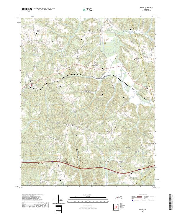
2022 Map of Rosine
USGS Topo · Published 2022About this map
Rosine and the neighboring community of Horse Branch anchor this portion of the Western Kentucky Coal Field, an area defined by its intricate system of ridges and hollows. The landscape is dense with family and community history, evidenced by the high concentration of small cemeteries such as Old Salem Cem, Leach-Hattler Cem, and Baizetown Cem that pepper the heights above Muddy Cr and Ford Run. The network of local roads, including Uncle Pen Ln and State Rte 1544, follows the natural contours of the land, connecting scattered settlements like Renfrow and White Run. Significant landmarks such as Tunnel Hill and Wildcat Knob break the horizon, while names like Crow Hollow and Rattlesnake Knob suggest the traditional character of these rural Ohio County uplands.
Find a feature on this map
104 named features on this map. Tap any name to fly to it.
Don’t see what you’re looking for? This feature index may not catch every label — zoom into the map to look around manually.
Map Details
Editions of this 2022 Rosine Map
This is the sole edition of this map. No revisions or reprints were ever made.
Other maps of this area

1907 · Whitesville
USGS Topo · 1:62,500

1909 · Whitesville
USGS Topo · 1:62,500

1909 · Hartford
USGS Topo · 1:62,500

1925 · Spring Lick
USGS Topo · 1:62,500

1932 · Fordsville
USGS Topo · 1:62,500

1953 · Dundee
USGS Topo · 1:24,000

1953 · Falls Of Rough
USGS Topo · 1:24,000

1954 · Evansville
USGS Topo · 1:250,000

1954 · Horton
USGS Topo · 1:24,000

1954 · Spring Lick
USGS Topo · 1:24,000