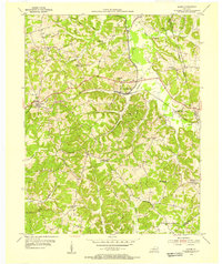
1954 Map of Rosine
USGS Topo · Published 1955About this map
Rosine serves as a focal point in this mid-century topographic study, situated along the Illinois Central railroad as it winds through the deeply dissected uplands of Kentucky. The landscape is defined by narrow ridges and winding creek valleys, including Horse Ridge, Pea Ridge, and Ford Ridge. These high points often host small rural communities and named landmarks like Rattlesnake Knob and Wildcat Knob.
Find a feature on this map
46 named features on this map. Tap any name to fly to it.
Don’t see what you’re looking for? This feature index may not catch every label — zoom into the map to look around manually.
Map Details
Editions of this 1954 Rosine Map
This is the sole edition of this map. No revisions or reprints were ever made.
Other maps of this area

1907 · Whitesville
USGS Topo · 1:62,500

1909 · Whitesville
USGS Topo · 1:62,500

1909 · Hartford
USGS Topo · 1:62,500

1925 · Spring Lick
USGS Topo · 1:62,500

1932 · Fordsville
USGS Topo · 1:62,500

1953 · Dundee
USGS Topo · 1:24,000

1953 · Falls Of Rough
USGS Topo · 1:24,000

1954 · Evansville
USGS Topo · 1:250,000

1954 · Horton
USGS Topo · 1:24,000

1954 · Spring Lick
USGS Topo · 1:24,000