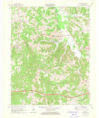
1971 Map of Rosine
USGS Topo · Published 1972About this map
Rosine and Horse Branch sit as central nodes within a landscape defined by the winding course of Caney Creek and the steel rails of the Illinois Central railroad. This 1971 revision captures the rural character of Ohio County just as the Western Kentucky Parkway established a modern corridor across the southern hills. The map provides significant genealogical value, documenting numerous family-named landmarks and local burial sites like McCord Cem, Wilson Cem, and Baizetown Cem. Community life is centered around local congregations such as Shiloh Ch and Leach Chapel. North of Rosine, the appearance of a Strip Mine and the Illinois Tunnel Hill highlights the region's intersection of coal mining and railroad engineering, while rugged elevations like Wildcat Knob and Rattlesnake Knob break the valley terrain.
Find a feature on this map
53 named features on this map. Tap any name to fly to it.
Don’t see what you’re looking for? This feature index may not catch every label — zoom into the map to look around manually.
Map Details
Editions of this 1971 Rosine Map
This is the sole edition of this map. No revisions or reprints were ever made.
Other maps of this area

1907 · Whitesville
USGS Topo · 1:62,500

1909 · Whitesville
USGS Topo · 1:62,500

1909 · Hartford
USGS Topo · 1:62,500

1925 · Spring Lick
USGS Topo · 1:62,500

1932 · Fordsville
USGS Topo · 1:62,500

1953 · Dundee
USGS Topo · 1:24,000

1953 · Falls Of Rough
USGS Topo · 1:24,000

1954 · Evansville
USGS Topo · 1:250,000

1954 · Horton
USGS Topo · 1:24,000

1954 · Spring Lick
USGS Topo · 1:24,000