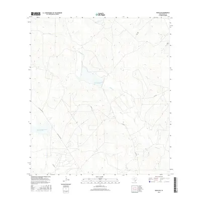
2016 Map of Rosita NE
USGS Topo · Published 2016About this map
Perez Cem and Garcia Cem stand as significant genealogical markers in this rural Duval County landscape, where family heritage is etched into the south Texas brush country. This 2016 survey illustrates a terrain defined by its drainage network, with the prominent Chiltipin Cr winding through the center of the quadrangle. Local water management is evident through the Soil Conservation Service Site 2 Reservoir, a critical feature for a region where seasonal creeks like Palo Amarillo Cr and San Diego Cr shape the movement and settlement patterns. The infrastructure is characterized by remote thoroughfares such as Old Seven Sisters Rd and El Toro Rd, which provide access to ranching lands and isolated homesteads. The distribution of these features reveals a landscape where modern soil conservation efforts coexist with long-established family burial grounds.
Find a feature on this map
14 named features on this map. Tap any name to fly to it.
Don’t see what you’re looking for? This feature index may not catch every label — zoom into the map to look around manually.
Map Details
Editions of this 2016 Rosita NE Map
This is the sole edition of this map. No revisions or reprints were ever made.
Other maps of this area

1920 · Mikeska
USGS Topo · 1:125,000

1920 · San Diego
USGS Topo · 1:62,500

1953 · Crystal City
USGS Topo · 1:250,000

1955 · Crystal City
USGS Topo · 1:250,000

1956 · Rosita Ranch
USGS Topo · 1:62,500

1956 · Laredo
USGS Topo · 1:250,000

1961 · Crystal City
USGS Topo · 1:250,000
1963 · Anna Rose
USGS Topo · 1:24,000

1963 · San Diego
USGS Topo · 1:24,000
1963 · Shaeffer Ranch
USGS Topo · 1:24,000