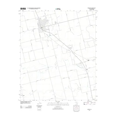
2012 Map of Rotan
USGS Topo · Published 2012About this map
Rotan serves as the primary hub of this West Texas landscape, defined by a rectilinear street grid and a network of county roads that service the surrounding agricultural plains. The town's layout, centered on corridors like N Harrison Ave and W Snyder Ave, reflects a classic rural Texas settlement pattern where commerce and community life are closely tied to the transport of local goods. To the east and south, the smaller localities of North Roby and Fisher represent the persistent rural character of the county.
Find a feature on this map
60 named features on this map. Tap any name to fly to it.
Don’t see what you’re looking for? This feature index may not catch every label — zoom into the map to look around manually.
Map Details
Editions of this 2012 Rotan Map
This is the sole edition of this map. No revisions or reprints were ever made.
Other maps of this area

1893 · Roby
USGS Topo · 1:125,000

1926 · Snyder 1-a
USGS Topo · 1:48,000

1926 · Roby 2-b
USGS Topo · 1:48,000

1931 · Rotan
USGS Topo · 1:62,500

1932 · Camp Springs
USGS Topo · 1:62,500

1954 · Big Spring
USGS Topo · 1:250,000

1958 · Big Spring
USGS Topo · 1:250,000
1969 · White Canyon
USGS Topo · 1:24,000
1969 · Poke Mountain
USGS Topo · 1:24,000

1969 · Rotan
USGS Topo · 1:24,000