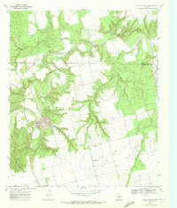
1969 Map of White Canyon
USGS Topo · Published 1972About this map
The Double Mountain Fork Brazos River carves a deep, winding path through the northern landscape of this 1969 survey, eventually joining the main stem of the Brazos River. This region on the border of Stonewall Co and Fisher Co is defined by its industrial activity, marked by an expansive Oil Field and several Gravel Pits. A significant Strip Mine sits centrally in the terrain, illustrating the extractive economy of the late 1960s.
Find a feature on this map
22 named features on this map. Tap any name to fly to it.
Don’t see what you’re looking for? This feature index may not catch every label — zoom into the map to look around manually.
Map Details
Editions of this 1969 White Canyon Map
This is the sole edition of this map. No revisions or reprints were ever made.
Other maps of this area

1893 · Roby
USGS Topo · 1:125,000

1926 · Snyder 1-a
USGS Topo · 1:48,000

1926 · Roby 2-b
USGS Topo · 1:48,000

1931 · Rotan
USGS Topo · 1:62,500

1932 · Camp Springs
USGS Topo · 1:62,500

1954 · Lubbock
USGS Topo · 1:250,000

1954 · Big Spring
USGS Topo · 1:250,000

1958 · Big Spring
USGS Topo · 1:250,000

1968 · Double Mountains
USGS Topo · 1:24,000
1968 · Coon Hollow
USGS Topo · 1:24,000