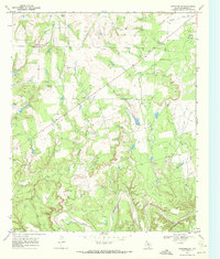
1968 Map of Coon Hollow
USGS Topo · Published 1972About this map
The Double Mountain Fork Brazos River winds through the southern reaches of this landscape, carving a deep path near several smaller tributaries like Salt Creek and Coon Hollow. In the late 1960s, the region's economy was clearly defined by resource extraction and aviation. The Frankirk Oil Field is a prominent feature in the southeast, characterized by several oil wells and drill holes, while multiple Gravel Pits dot the northern hills near Eagle Hill. Local community life is anchored by family-named landmarks such as Johnson Ch and Johnson Cem, providing valuable points of interest for genealogical research. The presence of the Aspermont Landing Field and a nearby golf course suggests a hub of activity just outside the immediate town center, where transportation and recreation met the rugged terrain of West Texas.
Find a feature on this map
15 named features on this map. Tap any name to fly to it.
Don’t see what you’re looking for? This feature index may not catch every label — zoom into the map to look around manually.
Map Details
Editions of this 1968 Coon Hollow Map
This is the sole edition of this map. No revisions or reprints were ever made.
Other maps of this area

1893 · Roby
USGS Topo · 1:125,000

1926 · Roby 2-b
USGS Topo · 1:48,000

1931 · Rotan
USGS Topo · 1:62,500

1931 · Aspermont
USGS Topo · 1:62,500

1954 · Lubbock
USGS Topo · 1:250,000

1954 · Big Spring
USGS Topo · 1:250,000

1958 · Big Spring
USGS Topo · 1:250,000
1965 · Hamlin NW
USGS Topo · 1:24,000

1968 · Double Mountains
USGS Topo · 1:24,000
1968 · Aspermont
USGS Topo · 1:24,000