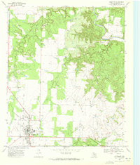
1968 Map of Aspermont
USGS Topo · Published 1972About this map
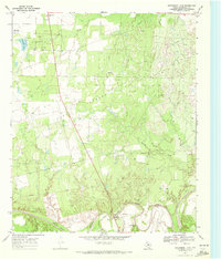
The county seat of Aspermont serves as the focal point for this late-1960s survey of Stonewall County, where the plains meet the deeply eroded breaks of the Salt Fork Brazos River. The town layout is clearly defined along Swenson Ave, featuring local landmarks like the High Sch, the Stonewall Memorial Hospital, and social hubs such as the Rodeo Ground and a Drive-in Theater. Beyond the settlement, the landscape is heavily influenced by the petroleum industry, dominated by the Boyd Oil Field and numerous scattered Oil Wells. The transportation history of the region is etched into the terrain via an Old Railroad Grade and an Old Pipeline, tracing former routes across the drainage basins of Stinking Creek and Turtle Creek. Genealogists may find value in the location of the Shadle Cem, situated northwest of the main town site.
Find a feature on this map
29 named features on this map. Tap any name to fly to it.
Don’t see what you’re looking for? This feature index may not catch every label — zoom into the map to look around manually.
Map Details
Editions of this 1968 Aspermont Map
This is the sole edition of this map. No revisions or reprints were ever made.
Other maps of this area

1925 · Aspermont 4-a
USGS Topo · 1:48,000

1931 · Aspermont
USGS Topo · 1:62,500

1954 · Lubbock
USGS Topo · 1:250,000

1958 · Lovers Resort
USGS Topo · 1:24,000

1962 · Kiowa Peak
USGS Topo · 1:24,000
1962 · Frog Mountain
USGS Topo · 1:24,000

1967 · Kiowa Peak SW
USGS Topo · 1:24,000
1968 · Coon Hollow
USGS Topo · 1:24,000
1968 · Swenson
USGS Topo · 1:24,000
1969 · Aspermont Lake
USGS Topo · 1:24,000