
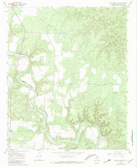
1967 Map of Kiowa Peak SW
USGS Topo · Published 1971About this map
The Salt Fork Brazos River carves a winding path through this portion of Stonewall County, defining a landscape dominated by ranching and petroleum extraction in the late 1960s. The northern reaches are occupied by the Bissett Ranch Oil Field, where numerous Oil Wells and pipelines indicate the region's industrial character. Settlement is sparse, represented by small locales such as Easy, Charlie, and Baker, which serve as quiet markers of rural Texas life. Cultural landmarks like the Mt Olive Cem provide a point of reference for genealogists tracing local families. The terrain is further shaped by seasonal drainages including Wedington Creek and Stinking Creek, while the presence of several Gravel Pits and a Prospect suggest a reliance on the land's raw materials during this era of Texas development.
Find a feature on this map
14 named features on this map. Tap any name to fly to it.
Don’t see what you’re looking for? This feature index may not catch every label — zoom into the map to look around manually.
Map Details
Editions of this 1967 Kiowa Peak SW Map
2 editions found
Other maps of this area

1925 · Aspermont 4-a
USGS Topo · 1:48,000

1931 · Aspermont
USGS Topo · 1:62,500

1954 · Lubbock
USGS Topo · 1:250,000

1958 · Lovers Resort
USGS Topo · 1:24,000

1959 · Bob Creek
USGS Topo · 1:24,000

1962 · Kiowa Peak
USGS Topo · 1:24,000

1967 · Kiowa Peak NW
USGS Topo · 1:24,000

1967 · Kiowa Peak NE
USGS Topo · 1:24,000
1968 · Aspermont
USGS Topo · 1:24,000
1968 · Swenson
USGS Topo · 1:24,000