
1967 Map of Kiowa Peak NW
USGS Topo · Published 1970About this map
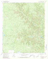
Big Buffalo Creek and North Croton Creek carve through the landscape along the King Co Stonewall Co border during the late 1960s. The terrain is defined by a complex network of drainages and seasonal water sources like Pen Branch Tank and Pen Branch. Evidence of ranching and early energy exploration is scattered throughout the region, most notably at the J M A Ranch and several Drill Holes. The presence of an Oil Well and a Gravel Pit indicates the local extraction industry of the era, while a system of Jeep Trails provides the primary means of navigating this dissected terrain. An Indefinite Boundary marks the dividing line between the two counties in this sparsely settled portion of West Texas.
Find a feature on this map
11 named features on this map. Tap any name to fly to it.
Don’t see what you’re looking for? This feature index may not catch every label — zoom into the map to look around manually.
Map Details
Editions of this 1967 Kiowa Peak NW Map
2 editions found
Other maps of this area

1954 · Lubbock
USGS Topo · 1:250,000

1958 · Lovers Resort
USGS Topo · 1:24,000

1959 · Bob Creek
USGS Topo · 1:24,000

1962 · Kiowa Peak
USGS Topo · 1:24,000

1967 · Dark Canyon
USGS Topo · 1:24,000

1967 · Kiowa Peak NE
USGS Topo · 1:24,000
1967 · Buzzard Peak
USGS Topo · 1:24,000

1967 · Kiowa Peak SW
USGS Topo · 1:24,000

1968 · Guthrie
USGS Topo · 1:24,000

1985 · Dickens
USGS Topo · 1:100,000