
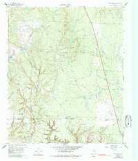
1959 Map of Bob Creek
USGS Topo · Published 1960About this map
The Salt Fork Brazos River anchors the southern edge of this West Texas landscape, where the King Co Stonewall Co line cuts through a region defined by ranching and resource extraction. The map reveals a transition in land use, documented as the Martin Ranch sat inactive near the center of the survey. Significant water features like Deadmans Hole and seasonal drainages such as Bob Creek and Pen Branch characterize the arid topography. Genealogy interests are centered at the Gilberton Cem on the western edge, while a single Oil Well indicates the burgeoning industrial footprint in this rural portion of Texas. This survey captures the area just as aerial photogrammetry was becoming the standard for documenting the state's wide-open ranch lands.
Find a feature on this map
12 named features on this map. Tap any name to fly to it.
Don’t see what you’re looking for? This feature index may not catch every label — zoom into the map to look around manually.
Map Details
Editions of this 1959 Bob Creek Map
2 editions found
Other maps of this area

1954 · Lubbock
USGS Topo · 1:250,000

1958 · Southerland Canyon
USGS Topo · 1:24,000

1958 · Seven Diamond L Canyon
USGS Topo · 1:24,000

1958 · Lovers Resort
USGS Topo · 1:24,000

1967 · Dark Canyon
USGS Topo · 1:24,000

1967 · Kiowa Peak NW
USGS Topo · 1:24,000

1967 · Kiowa Peak SW
USGS Topo · 1:24,000

1968 · Guthrie
USGS Topo · 1:24,000

1968 · Pitchfork Flats
USGS Topo · 1:24,000

1985 · Dickens
USGS Topo · 1:100,000