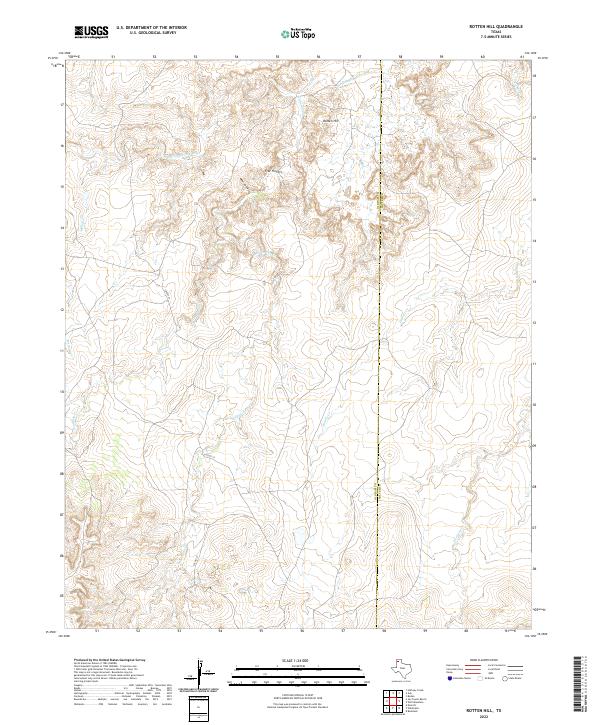
2022 Map of Rotten Hill
USGS Topo · Published 2022About this map
Rotten Hill stands as the primary landmark in this section of the Texas Panhandle, overlooking a complex network of ephemeral drainage systems. The landscape is defined by the sharp incisions of Sierrita de la Cruz Cr and the multi-branched formation known as Five Fingers. These geological features, along with Hard Draw, suggest a terrain of significant elevation changes and erosion, characteristic of the breaks near the Canadian River valley.
Find a feature on this map
12 named features on this map. Tap any name to fly to it.
Don’t see what you’re looking for? This feature index may not catch every label — zoom into the map to look around manually.
Map Details
Editions of this 2022 Rotten Hill Map
This is the sole edition of this map. No revisions or reprints were ever made.
Other maps of this area

1934 · Ady
USGS Topo · 1:62,500

1936 · Ady
USGS Topo · 1:62,500

1954 · Tucumcari
USGS Topo · 1:250,000

1958 · Tucumcari
USGS Topo · 1:250,000

1962 · Wildorado
USGS Topo · 1:62,500

1965 · Everett
USGS Topo · 1:24,000
1966 · Boden
USGS Topo · 1:24,000

1966 · Jay Taylor Ranch
USGS Topo · 1:24,000

1966 · Halfway Creek
USGS Topo · 1:24,000

1966 · Ady
USGS Topo · 1:24,000