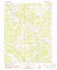
1987 Map of Roubidoux
USGS Topo · Published 1987About this map
Roubidoux Creek carves a winding path through the Ozark landscape of Texas County, Missouri, anchoring a network of hollows and small settlements. In this 1980s landscape, the small communities of Turley and Roubidoux stand as central points for local residents, connected by a system of improved and unimproved roads. The topography is defined by significant drainage systems, including the West Fork and East Fork which meet south of the Roubidoux settlement, and the Wolf Creek drainage that cuts across the western portion of the township. Much of the northern and eastern sections are integrated into the Mark Twain National Forest, illustrating the region's character as a mix of managed timberland and private agricultural valleys. Genealogists and historians can trace family land ties through named terrain features like Price Hollow, Jackson Hollow, and Burkhart Hollow, which often reflect the surnames of the families who settled these deep Ozark valleys.
Find a feature on this map
22 named features on this map. Tap any name to fly to it.
Don’t see what you’re looking for? This feature index may not catch every label — zoom into the map to look around manually.
Map Details
Editions of this 1987 Roubidoux Map
This is the sole edition of this map. No revisions or reprints were ever made.
Other maps of this area

1931 · Manes
USGS Topo · 1:48,000

1941 · Big Piney
USGS Topo · 1:62,500

1941 · Manes
USGS Topo · 1:62,500

1941 · Bado
USGS Topo · 1:62,500

1943 · Big Piney
USGS Topo · 1:62,500

1943 · Manes
USGS Topo · 1:62,500

1943 · Drynob
USGS Topo · 1:62,500

1943 · Bado
USGS Topo · 1:62,500

1954 · Springfield
USGS Topo · 1:250,000

1954 · Drynob
USGS Topo · 1:62,500