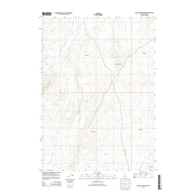
2013 Map of Rough Mountain NE
USGS Topo · Published 2013About this map
Castle Cr and several significant desert washes define this high-plateau drainage system in southwestern Idaho. The area is characterized by a network of seasonal watercourses, including Birch Creek, Garbutt Wash, and Cloudburst Wash, which carve through the arid terrain of Owyhee County. The presence of the Poison Creek Cutoff road indicates the historical importance of overland routes across this landscape, providing a vital connection through the expansive t5s r1e and t6s r2e township divisions. Topographic data from the U.S. Geological Survey highlights the sharp transitions near Poison Gulch and the winding path of McKeeth Wash, illustrating the complex natural irrigation and erosion patterns typical of the region's volcanic geography.
Find a feature on this map
12 named features on this map. Tap any name to fly to it.
Don’t see what you’re looking for? This feature index may not catch every label — zoom into the map to look around manually.
Map Details
Editions of this 2013 Rough Mountain NE Map
This is the sole edition of this map. No revisions or reprints were ever made.
Other maps of this area

1892 · Bisuka
USGS Topo · 1:125,000

1894 · Bisuka
USGS Topo · 1:125,000

1947 · Grand View
USGS Topo · 1:62,500

1947 · Jackass Butte
USGS Topo · 1:24,000

1947 · Vinson Wash
USGS Topo · 1:24,000

1947 · Perjue Canyon
USGS Topo · 1:24,000

1948 · Castle Butte
USGS Topo · 1:24,000

1948 · Perjue Canyon
USGS Topo · 1:24,000

1948 · Vinson Wash
USGS Topo · 1:24,000

1948 · Jackass Butte
USGS Topo · 1:24,000