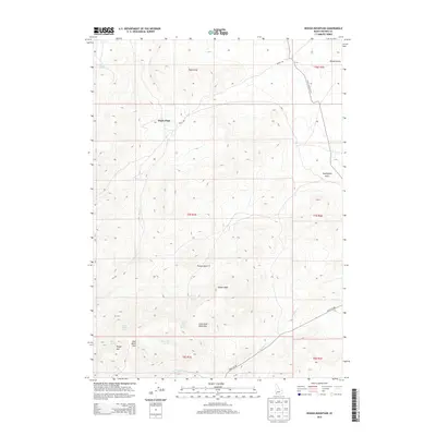
2013 Map of Rough Mountain
USGS Topo · Published 2013About this map
Doyle Place stands as a lonely point of human settlement in this high-desert landscape of southwestern Idaho. Located in the northern reaches of the quadrangle, it is connected to the wider world by Doyle Rd and the Poison Creek Cutoff. The terrain is defined by dramatic elevation changes, rising toward the summit of Rough Mtn and passing through natural gaps like Half Moon Pass and Little Half Moon Pass.
Find a feature on this map
25 named features on this map. Tap any name to fly to it.
Don’t see what you’re looking for? This feature index may not catch every label — zoom into the map to look around manually.
Map Details
Editions of this 2013 Rough Mountain Map
This is the sole edition of this map. No revisions or reprints were ever made.
Other maps of this area

1947 · Grand View
USGS Topo · 1:62,500

1947 · Vinson Wash
USGS Topo · 1:24,000

1947 · Perjue Canyon
USGS Topo · 1:24,000

1948 · Perjue Canyon
USGS Topo · 1:24,000

1948 · Vinson Wash
USGS Topo · 1:24,000

1955 · Jordan Valley
USGS Topo · 1:250,000

1957 · Jordan Valley
USGS Topo · 1:250,000

1958 · Jordan Valley
USGS Topo · 1:250,000
1972 · Rough Mountain NE
USGS Topo · 1:24,000
1972 · Rough Mountain
USGS Topo · 1:24,000