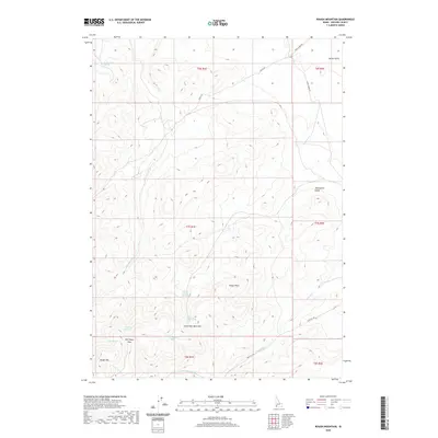
2020 Map of Rough Mountain
USGS Topo · Published 2020About this map
Rough Mtn anchors the high ground of this high-desert Owyhee County landscape, where water sources dictate the geography of human transit. The map reveals a network of vital watering points such as Lower Birch Spring, Horsehead Spring, and Half Moon Spring, which likely served as critical stops for livestock and travelers in this arid environment. The terrain is marked by significant drainages and passes, including Little Half Moon Pass and Half Moon Pass, providing natural corridors through the varied topography. This 2020 survey documents contemporary access via Mud Flat Rd and Missile Base Rd, reflecting both historical grazing routes and modern land use. The presence of features like Vinson Wash and Twentymile Gulch further illustrates the complex drainage systems that define this remote section of southwestern Idaho.
Find a feature on this map
25 named features on this map. Tap any name to fly to it.
Don’t see what you’re looking for? This feature index may not catch every label — zoom into the map to look around manually.
Map Details
Editions of this 2020 Rough Mountain Map
This is the sole edition of this map. No revisions or reprints were ever made.
Other maps of this area

1947 · Grand View
USGS Topo · 1:62,500

1947 · Vinson Wash
USGS Topo · 1:24,000

1947 · Perjue Canyon
USGS Topo · 1:24,000

1948 · Perjue Canyon
USGS Topo · 1:24,000

1948 · Vinson Wash
USGS Topo · 1:24,000

1955 · Jordan Valley
USGS Topo · 1:250,000

1957 · Jordan Valley
USGS Topo · 1:250,000

1958 · Jordan Valley
USGS Topo · 1:250,000
1972 · Rough Mountain NE
USGS Topo · 1:24,000
1972 · Rough Mountain
USGS Topo · 1:24,000