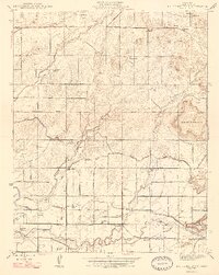
1947 Map of Round Mountain
USGS Topo · Published 1947About this map
The agricultural landscape of eastern Fresno County is defined by a sophisticated irrigation network including the Friant-Kern Canal, Enterprise Canal, and Gould Canal. At the time of this 1946 revision, the region supported numerous family-run operations such as Sunland Ranch, Baird Ranch, and McLaglen Ranch. These ranches are interspersed with small community clusters like Gray Colony and Fairview, each anchored by local education hubs like the Gray Colony School and Fairview School. The southern portion of the map is dominated by the Atchison Topeka and Santa Fe Railway line, facilitating the movement of goods from settlements like Zediker and Big Bunch. From the prominent peak of Round Mountain to the banks of Fancher Creek, the map captures a period of intense rural development where water management and rail access transformed the valley floor into a productive ranching corridor.
Find a feature on this map
49 named features on this map. Tap any name to fly to it.
Don’t see what you’re looking for? This feature index may not catch every label — zoom into the map to look around manually.
Map Details
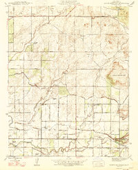
Editions of this 1947 Round Mountain Map
2 editions found
Other maps of this area

1920 · Orangedale School
USGS Topo · 1:24,000

1922 · Round Mountain
USGS Topo · 1:31,680

1922 · Trimmer
USGS Topo · 1:96,000

1922 · Friant
USGS Topo · 1:31,680

1923 · Malaga
USGS Topo · 1:31,680

1923 · Academy
USGS Topo · 1:31,680

1923 · Orangedale School
USGS Topo · 1:31,680

1923 · Clovis
USGS Topo · 1:31,680

1923 · Wahtoke
USGS Topo · 1:31,680

1923 · Sanger
USGS Topo · 1:31,680