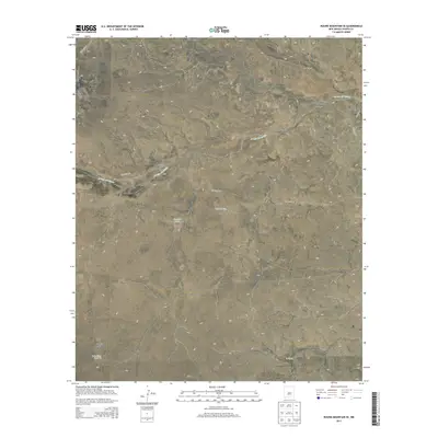
2013 Map of Round Mountain SE
USGS Topo · Published 2013About this map
McDaniels Ranch and Johnson Ranch anchor this high-desert landscape in Chaves County, revealing the sparse, ranch-based settlement patterns of southeastern New Mexico. The terrain is defined by a network of ephemeral watercourses including Gallo Arroyo, Arroyo del Macho, and Fourmile Draw, which shape the land between wide plateaus. This 2013 survey illustrates the vital infrastructure required for remote ranching, where isolated landmarks like the New Windmill and several catchment basins such as Twin Tanks and Columbus Tank serve as critical points for livestock and land management. The sparse road network, featuring Stargrass Rd and Silverweed Rd, provides the only major access through these large grazing allotments and draws.
Find a feature on this map
19 named features on this map. Tap any name to fly to it.
Don’t see what you’re looking for? This feature index may not catch every label — zoom into the map to look around manually.
Map Details
Editions of this 2013 Round Mountain SE Map
This is the sole edition of this map. No revisions or reprints were ever made.
Other maps of this area

1955 · Roswell
USGS Topo · 1:250,000

1958 · Roswell
USGS Topo · 1:250,000

1962 · Roswell
USGS Topo · 1:250,000

1962 · Rock House Canyon
USGS Topo · 1:24,000

1967 · Round Mountain SE
USGS Topo · 1:24,000

1967 · North Lake
USGS Topo · 1:24,000

1967 · White Flat
USGS Topo · 1:24,000

1967 · Round Mountain
USGS Topo · 1:24,000

1967 · Chivata Canyon
USGS Topo · 1:24,000
1967 · Mesa SW
USGS Topo · 1:24,000