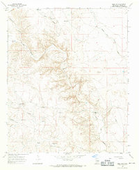
1967 Map of Mesa SW
USGS Topo · Published 1971About this map
Boswell Ranch and the family operations of J M McKnight Ranch and W R McKnight Ranch define this livestock-driven landscape in eastern New Mexico during the late 1960s. The terrain is a complex network of ephemeral drainage systems, including Fifteenmile Arroyo, Fourmile Draw, and the prominent Arroyo del Macho. Water management is the primary marker of human presence here, evidenced by numerous livestock watering sites such as Little Burts Tank, Burts Tank, Wells Tank, and China Draw Well. The sparse infrastructure consists primarily of unimproved roads and fine red-dashed fence lines, illustrating the expansive nature of high-desert ranching. Small pockets of activity are noted at Knight and the Paree Ranch, while a lone Gravel Pit indicates local material extraction amidst the draws and canyons like Burts Canyon.
Find a feature on this map
21 named features on this map. Tap any name to fly to it.
Don’t see what you’re looking for? This feature index may not catch every label — zoom into the map to look around manually.
Map Details
Editions of this 1967 Mesa SW Map
2 editions found
Other maps of this area

1955 · Roswell
USGS Topo · 1:250,000

1958 · Roswell
USGS Topo · 1:250,000

1962 · Roswell
USGS Topo · 1:250,000

1962 · Rock House Canyon
USGS Topo · 1:24,000

1962 · Marley Draw
USGS Topo · 1:24,000

1967 · Round Mountain SE
USGS Topo · 1:24,000

1967 · Round Mountain
USGS Topo · 1:24,000

1967 · Dunlap Sill
USGS Topo · 1:24,000
1967 · Mesa SE
USGS Topo · 1:24,000
1967 · Mesa
USGS Topo · 1:24,000