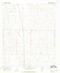
1967 Map of Mesa SE
USGS Topo · Published 1971About this map
Martin Ranch and Daniels Ranch anchor this landscape of the High Plains in Chaves County, where water management defines the pattern of human settlement. The 1967 survey illustrates a reliance on distributed water sources across the arid terrain, ranging from specialized infrastructure like the Askew Windmill and Partnership Well to numerous livestock watering points such as Fivemile Tank and Cottonwood Tank. The drainage of Fivemile Draw cuts across the center of the sheet, providing a natural corridor through the ranching country.
Find a feature on this map
17 named features on this map. Tap any name to fly to it.
Don’t see what you’re looking for? This feature index may not catch every label — zoom into the map to look around manually.
Map Details
Editions of this 1967 Mesa SE Map
2 editions found
Other maps of this area

1955 · Roswell
USGS Topo · 1:250,000

1958 · Roswell
USGS Topo · 1:250,000

1962 · Roswell
USGS Topo · 1:250,000

1962 · Rock House Canyon
USGS Topo · 1:24,000

1962 · Marley Draw
USGS Topo · 1:24,000

1963 · Coyote Draw
USGS Topo · 1:24,000

1967 · Dunlap Sill
USGS Topo · 1:24,000

1967 · Swallow Nest Canyon
USGS Topo · 1:24,000
1967 · Mesa SW
USGS Topo · 1:24,000
1967 · Shannon Draw
USGS Topo · 1:24,000