
1967 Map of Swallow Nest Canyon
USGS Topo · Published 1971About this map
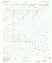
Sacra Ranch sits near the northwestern corner of this New Mexico landscape, which is defined by the complex drainage systems of Swallow Nest Canyon and Rattlesnake Canyon. This 1967 field-checked survey reveals an arid rangeland where life and labor are organized around scarce water sources. The distribution of isolated sites like the Cavel Sch and the School Section Well illustrates the sparse settlement patterns typical of the high plains near the De Baca and Chaves County line.
Find a feature on this map
26 named features on this map. Tap any name to fly to it.
Don’t see what you’re looking for? This feature index may not catch every label — zoom into the map to look around manually.
Map Details
Editions of this 1967 Swallow Nest Canyon Map
2 editions found
Other maps of this area

1954 · Fort Sumner
USGS Topo · 1:250,000

1955 · Roswell
USGS Topo · 1:250,000

1958 · Fort Sumner
USGS Topo · 1:250,000

1958 · Roswell
USGS Topo · 1:250,000

1962 · Roswell
USGS Topo · 1:250,000

1967 · Deering Place
USGS Topo · 1:24,000

1967 · Cottonwood Draw
USGS Topo · 1:24,000

1967 · Dunlap Sill
USGS Topo · 1:24,000
1967 · Mesa SE
USGS Topo · 1:24,000
1967 · Lovelady Draw
USGS Topo · 1:24,000