
1967 Map of Cottonwood Draw
USGS Topo · Published 1971About this map
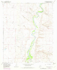
The Pecos River carves a green corridor through the arid drainage basins of Chaves County, defining a landscape of ranching and water management in the late 1960s. Settled outposts such as Benedict Ranch and Cottonwood Ranch are situated near the complex network of ephemeral watercourses, including Cottonwood Draw and Alkali Draw, which channel seasonal runoff toward the river valley. The map reveals an intensive reliance on subterranean water sources, marked by numerous named landmarks like Badger Well, Indian Well, and Rabbit Well, alongside the functional River Windmill. Evidence of late-century resource exploration is visible through scattered Oil Well sites and Drill Holes, particularly near the settlement of Bosque. This survey documents a critical junction of traditional New Mexico ranching and modern industrial utility, punctuated by essential landmarks like the Ford and several permanent water sources including Sixmile Spring.
Find a feature on this map
34 named features on this map. Tap any name to fly to it.
Don’t see what you’re looking for? This feature index may not catch every label — zoom into the map to look around manually.
Map Details
Editions of this 1967 Cottonwood Draw Map
2 editions found
Other maps of this area

1955 · Roswell
USGS Topo · 1:250,000

1958 · Roswell
USGS Topo · 1:250,000

1962 · Roswell
USGS Topo · 1:250,000

1962 · Eightmile Draw
USGS Topo · 1:24,000

1963 · Coyote Draw
USGS Topo · 1:24,000

1967 · Deering Place
USGS Topo · 1:24,000

1967 · Haystack Mountain
USGS Topo · 1:24,000

1967 · Swallow Nest Canyon
USGS Topo · 1:24,000

1967 · Hernandez Lake
USGS Topo · 1:24,000
1967 · Haystack Butte
USGS Topo · 1:24,000