
1967 Map of Haystack Mountain
USGS Topo · Published 1971About this map
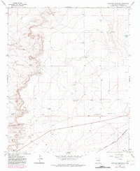
Haystack Mountain rises above a landscape defined by ranching and early petroleum exploration in Chaves County. This 1960s environment shows a scattered network of water sources essential for desert survival, from the seasonal Samples Lake to established points like Leslie Spring and various man-made developments including Williams Well and Hackett Well. The presence of the Atchison Topeka and Santa Fe railroad in the south, running through Acme, highlights the importance of rail transport for moving livestock and resources from the local ranches. Named sites such as Smith Ranch and Faircloth Ranch indicate the family-centered nature of land ownership during this era. Industrial activity is evident through numerous Oil Wells, a Gravel Pit, and the marking of several Drill Holes, suggesting a period of transition as traditional ranching shared the terrain with growing mineral interests.
Find a feature on this map
26 named features on this map. Tap any name to fly to it.
Don’t see what you’re looking for? This feature index may not catch every label — zoom into the map to look around manually.
Map Details
Editions of this 1967 Haystack Mountain Map
2 editions found
Other maps of this area

1955 · Roswell
USGS Topo · 1:250,000

1958 · Roswell
USGS Topo · 1:250,000

1962 · Roswell
USGS Topo · 1:250,000

1962 · Eightmile Draw
USGS Topo · 1:24,000

1962 · Acme
USGS Topo · 1:24,000
1967 · Campbell
USGS Topo · 1:24,000

1967 · Cottonwood Draw
USGS Topo · 1:24,000
1967 · Haystack Butte
USGS Topo · 1:24,000

1967 · Elkins
USGS Topo · 1:24,000
1967 · Denton Camp
USGS Topo · 1:24,000