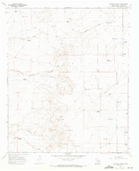
1967 Map of Haystack Butte
USGS Topo · Published 1971About this map
Haystack Butte and its smaller counterpart, Little Haystack, dominate this arid Chaves County landscape, where survival and industry are defined by sparse water sources. The 1967 survey reveals a network of remote ranching operations, including the South Van Eaton Ranch and the Chatten-Muncy Ranch, connected by unimproved dirt tracks and the prominent north-south Olive Road.
Find a feature on this map
38 named features on this map. Tap any name to fly to it.
Don’t see what you’re looking for? This feature index may not catch every label — zoom into the map to look around manually.
Map Details
Editions of this 1967 Haystack Butte Map
2 editions found
Other maps of this area

1955 · Roswell
USGS Topo · 1:250,000

1958 · Roswell
USGS Topo · 1:250,000

1962 · Roswell
USGS Topo · 1:250,000

1962 · Eightmile Draw
USGS Topo · 1:24,000

1967 · Deering Place
USGS Topo · 1:24,000

1967 · Haystack Mountain
USGS Topo · 1:24,000

1967 · Cottonwood Draw
USGS Topo · 1:24,000

1967 · Hernandez Lake
USGS Topo · 1:24,000

1967 · Elkins
USGS Topo · 1:24,000
1967 · Denton Camp
USGS Topo · 1:24,000