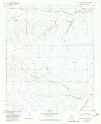
1967 Map of Swallow Nest Canyon
USGS Topo · Published 1982About this map
Saera Ranch and a network of isolated water wells define this arid landscape along the border of De Baca and Chaves counties during the mid-to-late 1960s. The terrain is deeply cut by seasonal drainages including Wylie Draw, South Wylie Draw, and Huggins Draw, which converge toward the southeast. These watercourses are supported by numerous vital water sources such as Headwater Spring, Blue Hole Spring, and Rattlesnake Spring, which were essential for ranching operations in this high-desert environment.
Find a feature on this map
28 named features on this map. Tap any name to fly to it.
Don’t see what you’re looking for? This feature index may not catch every label — zoom into the map to look around manually.
Map Details
Editions of this 1967 Swallow Nest Canyon Map
2 editions found
Other maps of this area

1954 · Fort Sumner
USGS Topo · 1:250,000

1955 · Roswell
USGS Topo · 1:250,000

1958 · Fort Sumner
USGS Topo · 1:250,000

1958 · Roswell
USGS Topo · 1:250,000

1962 · Roswell
USGS Topo · 1:250,000

1967 · Deering Place
USGS Topo · 1:24,000

1967 · Cottonwood Draw
USGS Topo · 1:24,000

1967 · Dunlap Sill
USGS Topo · 1:24,000

1967 · Swallow Nest Canyon
USGS Topo · 1:24,000
1967 · Mesa SE
USGS Topo · 1:24,000