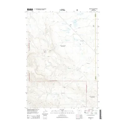
2014 Map of Roundtop
USGS Topo · Published 2014About this map
Joder sits in the northern reaches of this high plains landscape, situated near the intersection of Toadstool Rd and Linn St. This corner of Northwest Nebraska is characterized by a complex network of ephemeral waterways, including Big Cottonwood Cr and Dirty Cr, which feed into several small water management features such as Carmody Reservoir and Norman Reservoir Number 3. Much of the territory is managed as part of the Oglala National Grassland, where the terrain transitions from open flats to distinctive topographical features like Cedar Canyon and the Mike Kern Hills.
Find a feature on this map
26 named features on this map. Tap any name to fly to it.
Don’t see what you’re looking for? This feature index may not catch every label — zoom into the map to look around manually.
Map Details
Editions of this 2014 Roundtop Map
This is the sole edition of this map. No revisions or reprints were ever made.
Other maps of this area

1955 · Alliance
USGS Topo · 1:250,000

1957 · Alliance
USGS Topo · 1:250,000

1958 · Alliance
USGS Topo · 1:250,000

1980 · Horn
USGS Topo · 1:24,000

1980 · Montrose
USGS Topo · 1:24,000

1980 · Wolf Butte
USGS Topo · 1:24,000

1980 · Smiley Canyon
USGS Topo · 1:24,000

1980 · Five Points
USGS Topo · 1:24,000

1980 · Andrews
USGS Topo · 1:24,000
1980 · Orella
USGS Topo · 1:24,000