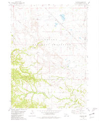
1980 Map of Roundtop
USGS Topo · Published 1981About this map
The Oglala National Grassland dominates this section of Sioux County, where the high plains transition through a series of dramatic drainages and badland formations. Sparse settlement in the late 1970s is evidenced by isolated outposts like Joder and Roundtop, which are supported by a network of rural schoolhouses including Norman Sch, Roundtop Sch, and Little Cottonwood Sch. This landscape is defined by its hydrology, with Whitehead Creek, Cottonwood Cr, and Sand Creek carving through the terrain near the Kern Hills. The Burlington Northern railroad cuts a diagonal path across the northern reaches, serving as a primary transit artery through an area otherwise characterized by landmarks like Eagles Eye Rock and the unique geology of Toadstool Park. Local history is anchored by the Union Star Cem, which serves the scattered ranching community found at places like Meng Ranch.
Find a feature on this map
20 named features on this map. Tap any name to fly to it.
Don’t see what you’re looking for? This feature index may not catch every label — zoom into the map to look around manually.
Map Details
Editions of this 1980 Roundtop Map
This is the sole edition of this map. No revisions or reprints were ever made.
Other maps of this area

1955 · Alliance
USGS Topo · 1:250,000

1957 · Alliance
USGS Topo · 1:250,000

1958 · Alliance
USGS Topo · 1:250,000

1980 · Horn
USGS Topo · 1:24,000

1980 · Montrose
USGS Topo · 1:24,000

1980 · Wolf Butte
USGS Topo · 1:24,000

1980 · Smiley Canyon
USGS Topo · 1:24,000

1980 · Five Points
USGS Topo · 1:24,000

1980 · Andrews
USGS Topo · 1:24,000
1980 · Orella
USGS Topo · 1:24,000