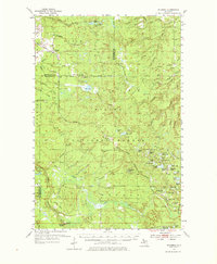
1954 Map of Rousseau
USGS Topo · Published 1976About this map
The timberlands and waterways of the Upper Peninsula define this mid-century landscape within the Ottawa National Forest. Small settlements such as Rousseau and Pori appear as modest clearings along the transport corridors, while specialized sites like the Michigan College of Mining Forestry Camp highlight the region's focus on natural resource management. The map details a complex hydrologic network, featuring curiously named water bodies such as Sudden Lake, Very Sudden Pond, and Perjury Creek.
Find a feature on this map
80 named features on this map. Tap any name to fly to it.
Don’t see what you’re looking for? This feature index may not catch every label — zoom into the map to look around manually.
Map Details
Editions of this 1954 Rousseau Map
3 editions found
Other maps of this area

1895 · Perch Lake
USGS Topo · 1:62,500

1949 · Rockland
USGS Topo · 1:62,500

1950 · Greenland
USGS Topo · 1:62,500

1951 · Rockland
USGS Topo · 1:62,500

1951 · Greenland
USGS Topo · 1:62,500

1952 · Watersmeet
USGS Topo · 1:62,500

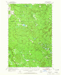
1954 · Rousseau
USGS Topo · 1:62,500

1954 · Kenton
USGS Topo · 1:62,500

1954 · Perch Lake
USGS Topo · 1:62,500

1954 · Pelkie
USGS Topo · 1:62,500