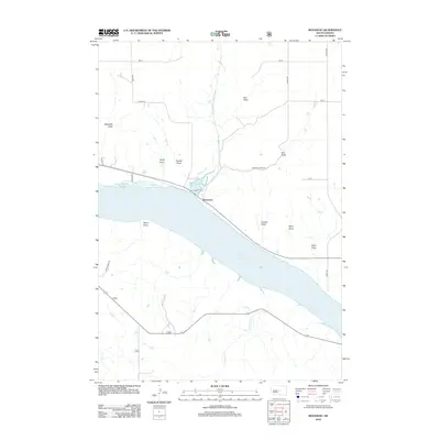
2012 Map of Rousseau
USGS Topo · Published 2012About this map
Lake Sharpe dominates this Hughes County landscape, where the Missouri River waters are impounded south of Rousseau. The area is characterized by a series of significant seasonal drainage channels or draws that carve through the prairie towards the river valley. These include Mosteller Draw, Kirley Draw, and Trumbo Draw to the west, while Elm Draw, Carlson Draw, and Tobin Draw define the eastern terrain.
Find a feature on this map
26 named features on this map. Tap any name to fly to it.
Don’t see what you’re looking for? This feature index may not catch every label — zoom into the map to look around manually.
Map Details
Editions of this 2012 Rousseau Map
This is the sole edition of this map. No revisions or reprints were ever made.
Other maps of this area

1934 · Canning
USGS Topo · 1:48,000

1937 · Canning
USGS Topo · 1:62,500

1953 · Huron
USGS Topo · 1:250,000

1954 · Pierre
USGS Topo · 1:250,000

1954 · Huron
USGS Topo · 1:250,000

1958 · Pierre
USGS Topo · 1:250,000

1966 · Joe Creek NW
USGS Topo · 1:24,000

1967 · Canning
USGS Topo · 1:24,000
1967 · Canning NW
USGS Topo · 1:24,000

1967 · Ft. George Butte NW
USGS Topo · 1:24,000