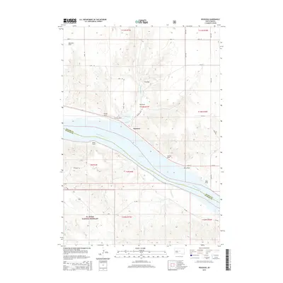
2015 Map of Rousseau
USGS Topo · Published 2015About this map
The Missouri River defines the landscape of this Central South Dakota region, where the Hughes Co Stanley Co boundary follows the winding waterway. The settlement of Rousseau sits on the northern bank, positioned near where Medicine Knoll Cr flows south toward the wider expanse of Lake Sharpe. This reservoir, created by the damming of the Missouri, submerged earlier riverbottom lands while creating the distinctive shoreline seen today.
Find a feature on this map
32 named features on this map. Tap any name to fly to it.
Don’t see what you’re looking for? This feature index may not catch every label — zoom into the map to look around manually.
Map Details
Editions of this 2015 Rousseau Map
This is the sole edition of this map. No revisions or reprints were ever made.
Other maps of this area

1934 · Canning
USGS Topo · 1:48,000

1937 · Canning
USGS Topo · 1:62,500

1953 · Huron
USGS Topo · 1:250,000

1954 · Pierre
USGS Topo · 1:250,000

1954 · Huron
USGS Topo · 1:250,000

1958 · Pierre
USGS Topo · 1:250,000

1966 · Joe Creek NW
USGS Topo · 1:24,000

1967 · Canning
USGS Topo · 1:24,000
1967 · Canning NW
USGS Topo · 1:24,000

1967 · Ft. George Butte NW
USGS Topo · 1:24,000