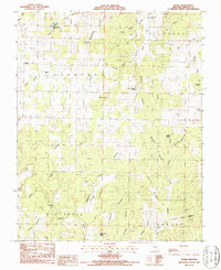
1986 Map of Rover
USGS Topo · Published 1990About this map
Rover anchors the northwestern corner of this mid-1980s landscape, where the terrain is defined by a dense network of hollows and named springs. The Ozark plateau character is evident in the numerous water sources such as Jolliff Spring, Watson Spring, and Granny Meyers Spring, which historically dictated the placement of small farmsteads and rural communities. In the southern portion of the sheet, the Big Spring River flows through the area, supported by tributaries like Watered Fork and Orchard Branch. Genealogy researchers will find significant value in the mapped locations of Redburn Cem, Union Hill Cem, and Howell Cem. The presence of crossing points like Elliott Ford and Culp Ford along Warm Fork and its branches reveals the traditional travel routes through the valley before more modern infrastructure predominated.
Find a feature on this map
46 named features on this map. Tap any name to fly to it.
Don’t see what you’re looking for? This feature index may not catch every label — zoom into the map to look around manually.
Map Details
Editions of this 1986 Rover Map
This is the sole edition of this map. No revisions or reprints were ever made.
Other maps of this area

1931 · Bandyville
USGS Topo · 1:48,000

1943 · Thayer
USGS Topo · 1:62,500

1944 · Couch
USGS Topo · 1:62,500

1944 · Birch Tree
USGS Topo · 1:62,500

1945 · Montier
USGS Topo · 1:62,500

1946 · Thayer
USGS Topo · 1:62,500

1946 · Couch
USGS Topo · 1:62,500

1948 · Montier
USGS Topo · 1:62,500

1948 · Birch Tree
USGS Topo · 1:62,500

1957 · Poplar Bluff
USGS Topo · 1:250,000