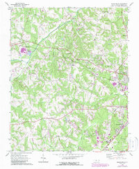
1969 Map of Rowan Mills
USGS Topo · Published 1987About this map
Rowan Mills and the western outskirts of Salisbury anchor this Piedmont landscape during a period of transition between its agrarian roots and industrial expansion. The Southern railroad lines intersect at Barber, a critical junction point where the rail infrastructure supported local industry and commerce. The map reveals a dense network of spiritual and social hubs, including St Matthews Ch, Millers Chapel, and Macedonia Ch, which served as the primary centers for rural communities.
Find a feature on this map
37 named features on this map. Tap any name to fly to it.
Don’t see what you’re looking for? This feature index may not catch every label — zoom into the map to look around manually.
Map Details
Editions of this 1969 Rowan Mills Map
2 editions found
Other maps of this area

1893 · Statesville
USGS Topo · 1:125,000

1950 · Churchland
USGS Topo · 1:24,000

1951 · Churchland
USGS Topo · 1:24,000

1953 · Charlotte
USGS Topo · 1:250,000

1954 · Charlotte
USGS Topo · 1:250,000

1960 · Charlotte
USGS Topo · 1:250,000

1962 · Charlotte
USGS Topo · 1:250,000
1962 · Salisbury
USGS Topo · 1:24,000
1962 · Rockwell
USGS Topo · 1:24,000

1969 · Cooleemee
USGS Topo · 1:24,000