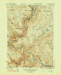
1947 Map of Rowe
USGS Topo · Published 1947About this map
The Deerfield River carves a deep valley through the Berkshire highlands in the late 1940s, serving as a critical corridor for industrial and transit infrastructure. The Boston and Maine Railroad winds alongside the water, disappearing into the monumental Hoosac Tunnel near the Hoosac Tunnel PO. This engineering marvel, coupled with the Sherman Dam and its reservoir, illustrates the mid-century reliance on the river for both power and passage.
Find a feature on this map
69 named features on this map. Tap any name to fly to it.
Don’t see what you’re looking for? This feature index may not catch every label — zoom into the map to look around manually.
Map Details
Editions of this 1947 Rowe Map
2 editions found
Other maps of this area

1886 · Greylock
USGS Topo · 1:62,500

1886 · Hawley
USGS Topo · 1:62,500

1889 · Wilmington
USGS Topo · 1:62,500

1890 · Hawley
USGS Topo · 1:62,500

1891 · Wilmington
USGS Topo · 1:62,500

1891 · Greylock
USGS Topo · 1:62,500

1893 · Greylock
USGS Topo · 1:62,500

1894 · Hawley
USGS Topo · 1:62,500

1898 · Bennington
USGS Topo · 1:62,500

1898 · Greylock
USGS Topo · 1:62,500