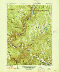
1947 Map of Rowe
USGS Topo · Published 1947About this map
The Deerfield River carves a deep, winding path through this 1940s landscape, serving as the industrial and logistical spine for mountain settlements. The engineering feat of the Hoosac Tunnel is prominently featured, showing the underground passage of the Boston and Maine Railroad as it pierces through the mountains to Whitcomb. This connectivity supported the local paper and pulp operations at Monroe Bridge, where the Sherman Reservoir and Sherman Dam regulate the river's power.
Find a feature on this map
82 named features on this map. Tap any name to fly to it.
Don’t see what you’re looking for? This feature index may not catch every label — zoom into the map to look around manually.
Map Details
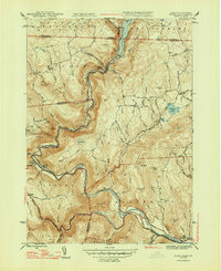
Editions of this 1947 Rowe Map
2 editions found
Other maps of this area

1886 · Greylock
USGS Topo · 1:62,500

1886 · Hawley
USGS Topo · 1:62,500

1889 · Wilmington
USGS Topo · 1:62,500

1890 · Hawley
USGS Topo · 1:62,500

1891 · Wilmington
USGS Topo · 1:62,500

1891 · Greylock
USGS Topo · 1:62,500

1893 · Greylock
USGS Topo · 1:62,500

1894 · Hawley
USGS Topo · 1:62,500

1898 · Bennington
USGS Topo · 1:62,500

1898 · Greylock
USGS Topo · 1:62,500