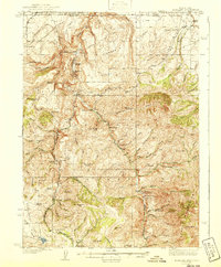
1940 Map of Rowland
USGS Topo · Published 1940About this map
The Bruneau River carves through this remote landscape along the Nevada-Idaho border, anchoring a network of early twentieth-century homesteads and ranching operations. Ranch life is the primary story here, with family-named holdings such as Knight Ranch, Strickland Ranch, and the Budde Rizzi Ranch scattered across the high desert and mountain draws. The tiny settlement of Rowland serves as a central point for the community, supported by the Bruneau Sch and local mining interests at Bruneau Mins.
Find a feature on this map
66 named features on this map. Tap any name to fly to it.
Don’t see what you’re looking for? This feature index may not catch every label — zoom into the map to look around manually.
Map Details
Editions of this 1940 Rowland Map
2 editions found
Other maps of this area

1935 · Charleston
USGS Topo · 1:48,000

1936 · Mountain City
USGS Topo · 1:62,500

1936 · Rowland
USGS Topo · 1:48,000

1940 · Rowland
USGS Topo · 1:62,500

1940 · Mountain City
USGS Topo · 1:62,500

1942 · Mt. Velma
USGS Topo · 1:62,500

1943 · Jarbidge
USGS Topo · 1:62,500

1945 · Jarbidge
USGS Topo · 1:62,500

1955 · Twin Falls
USGS Topo · 1:250,000

1955 · Wells
USGS Topo · 1:250,000