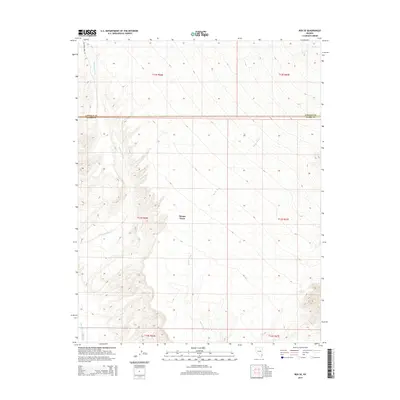
2014 Map of Rox SE
USGS Topo · Published 2014About this map
Moapa Town and the surrounding desert landscape of the Muddy River valley are defined by a network of drainage systems in this early twenty-first-century survey. The terrain is dominated by the broad, seasonal paths of Whitmore Wash and Weiser Wash, which trend southward toward the larger Meadow Valley Wash drainage. These natural corridors shaped early travel and settlement patterns along the Lincoln Co Clark Co border, where the land transitions through various township and range designations. Infrastructure is sparse in this arid stretch of southern Nevada, with Whitmore Wash Rd serving as a primary point of access into the interior. The map captures the delicate balance between the established settlement at Moapa Town and the expansive, undeveloped topography that characterizes this portion of the Mojave Desert.
Find a feature on this map
12 named features on this map. Tap any name to fly to it.
Don’t see what you’re looking for? This feature index may not catch every label — zoom into the map to look around manually.
Map Details
Editions of this 2014 Rox SE Map
This is the sole edition of this map. No revisions or reprints were ever made.
Other maps of this area

1886 · Saint Thomas
USGS Topo · 1:250,000

1893 · Saint Thomas
USGS Topo · 1:250,000

1954 · Las Vegas
USGS Topo · 1:250,000

1957 · Las Vegas
USGS Topo · 1:250,000

1958 · Moapa
USGS Topo · 1:62,500

1958 · Overton
USGS Topo · 1:62,500

1959 · Las Vegas
USGS Topo · 1:250,000

1962 · Las Vegas
USGS Topo · 1:250,000

1969 · Farrier
USGS Topo · 1:24,000
1969 · Rox
USGS Topo · 1:24,000