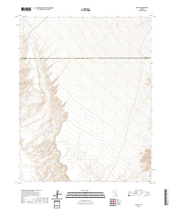
2021 Map of Rox SE
USGS Topo · Published 2021About this map
Meadow Valley Wash defines the southwestern corner of this desert landscape, where water drainage patterns have carved complex systems into the terrain. Situated along the boundary between Lincoln Co and Clark Co, the map reveals a vast network of ephemeral watercourses including Whitmore Wash and Weiser Wash. These washes represent the primary geographic features in a region dominated by the Public Land Survey System, as indicated by the various township and range designations such as t13s r66e and t13s r67e. The topography is characterized by deep ravines and alluvial fans, illustrating how seasonal water flow shapes the southern Nevada environment.
Find a feature on this map
10 named features on this map. Tap any name to fly to it.
Don’t see what you’re looking for? This feature index may not catch every label — zoom into the map to look around manually.
Map Details
Editions of this 2021 Rox SE Map
This is the sole edition of this map. No revisions or reprints were ever made.
Other maps of this area

1886 · Saint Thomas
USGS Topo · 1:250,000

1893 · Saint Thomas
USGS Topo · 1:250,000

1954 · Las Vegas
USGS Topo · 1:250,000

1957 · Las Vegas
USGS Topo · 1:250,000

1958 · Moapa
USGS Topo · 1:62,500

1958 · Overton
USGS Topo · 1:62,500

1959 · Las Vegas
USGS Topo · 1:250,000

1962 · Las Vegas
USGS Topo · 1:250,000

1969 · Farrier
USGS Topo · 1:24,000
1969 · Rox
USGS Topo · 1:24,000