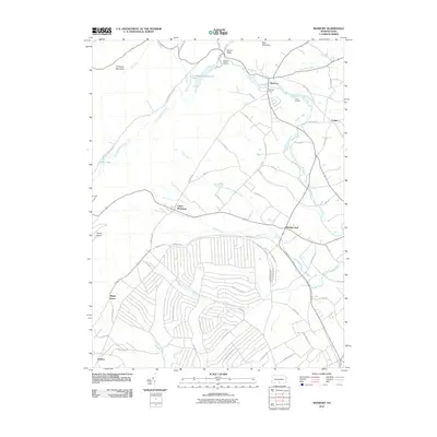
2010 Map of Roxbury
USGS Topo · Published 2010About this map
Conodoguinet Creek winds through the northern valleys of this Franklin County landscape, passing the small community of Roxbury and the recreational grounds of Holiness Camp and Camp Johnson. The terrain is defined by the sharp ridges of Blue Mountain and Timmons Mountain, which enclose the agricultural basins of Horse Valley and Gunter Valley. A significant portion of the southern geography is occupied by an intricate network of specialized roads, including Missile Rd, Tracer Rd, and Rocket Rd, alongside avenues named for various states. This distinctive infrastructure borders the traditional crossroads of Upper Strasburg and Pleasant Hall. The drainage system is equally complex, featuring Letterkenny Reservoir and numerous runs such as Lehman Run and Keasey Run that feed the local watershed. Further south, the settlements of Maple Grove and Keefers mark the transition toward more residential layouts, providing a clear view of the area's twentieth-century evolution.
Find a feature on this map
59 named features on this map. Tap any name to fly to it.
Don’t see what you’re looking for? This feature index may not catch every label — zoom into the map to look around manually.
Map Details
Editions of this 2010 Roxbury Map
This is the sole edition of this map. No revisions or reprints were ever made.
Other maps of this area

1900 · Mercersburg
USGS Topo · 1:62,500

1902 · Chambersburg
USGS Topo · 1:62,500

1902 · Mercersburg
USGS Topo · 1:62,500

1923 · Shippensburg
USGS Topo · 1:62,500

1939 · Orbisonia
USGS Topo · 1:62,500

1940 · Orbisonia
USGS Topo · 1:62,500

1942 · Hagerstown
USGS Topo · 1:125,000

1943 · Hagerstown
USGS Topo · 1:125,000

1943 · Chambersburg
USGS Topo · 1:62,500

1943 · Mercersburg
USGS Topo · 1:62,500
Featured Places
- Lurgan Township, PA
- Metal Township, PA
- Letterkenny Township, PA
- Pleasant Hall, Letterkenny Township
- Roxbury, Lurgan Township