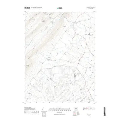
2019 Map of Roxbury
USGS Topo · Published 2019About this map
Kittatinny Mountain and Blue Mountain dominate the northwestern horizon of this Franklin County landscape, creating a dramatic backdrop for the valley settlements of Roxbury, Lurgan, and Upper Strasburg. The area is defined by a dense network of country roads and small communal centers, many anchored by longstanding religious sites such as the Old Order York Brethren Church and the Upper Strasburg Mennonite Church.
Find a feature on this map
96 named features on this map. Tap any name to fly to it.
Don’t see what you’re looking for? This feature index may not catch every label — zoom into the map to look around manually.
Map Details
Editions of this 2019 Roxbury Map
This is the sole edition of this map. No revisions or reprints were ever made.
Other maps of this area

1900 · Mercersburg
USGS Topo · 1:62,500

1902 · Chambersburg
USGS Topo · 1:62,500

1902 · Mercersburg
USGS Topo · 1:62,500

1923 · Shippensburg
USGS Topo · 1:62,500

1939 · Orbisonia
USGS Topo · 1:62,500

1940 · Orbisonia
USGS Topo · 1:62,500

1942 · Hagerstown
USGS Topo · 1:125,000

1943 · Hagerstown
USGS Topo · 1:125,000

1943 · Chambersburg
USGS Topo · 1:62,500

1943 · Mercersburg
USGS Topo · 1:62,500
Featured Places
- Lurgan Township, PA
- Metal Township, PA
- Letterkenny Township, PA
- Pleasant Hall, Letterkenny Township
- Roxbury, Lurgan Township