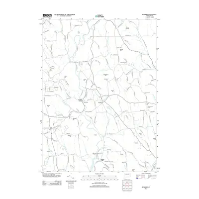
2012 Map of Roxbury
USGS Topo · Published 2012About this map
Roxbury and its surrounding hill country are defined by the winding course of the Shepaug River, which flows past the historically significant Roxbury Station and the settlement of Paquabaug. The landscape is dotted with numerous peaks and named heights, such as Mine Hill, Sentry Hill, and Moosehorn Hill, reflecting the area's complex topography. Local history is anchored by sites like the Center Cem and the Old Leavonworth Cem, while more recent developments include private airstrips like Good Hill Farm Airport and Canterbury Farm Airport. To the south, the terrain drops toward the Shepaug River's end at Lake Zoar near the cascading waters of Roxbury Falls. This map reveals a community where rural residential growth and preserved landmarks like the Roxbury Fire Tower coexist alongside old roads and family-named landmarks like Botsford Hill and Bulkeley Hill.
Find a feature on this map
178 named features on this map. Tap any name to fly to it.
Don’t see what you’re looking for? This feature index may not catch every label — zoom into the map to look around manually.
Map Details
Editions of this 2012 Roxbury Map
This is the sole edition of this map. No revisions or reprints were ever made.
Other maps of this area

1889 · Derby
USGS Topo · 1:62,500

1891 · Derby
USGS Topo · 1:62,500

1892 · Danbury
USGS Topo · 1:62,500

1892 · New Milford
USGS Topo · 1:62,500

1893 · Waterbury
USGS Topo · 1:62,500

1893 · New Milford
USGS Topo · 1:62,500

1893 · Derby
USGS Topo · 1:62,500

1904 · New Milford
USGS Topo · 1:62,500

1904 · Waterbury
USGS Topo · 1:62,500

1904 · Litchfield
USGS Topo · 1:125,000