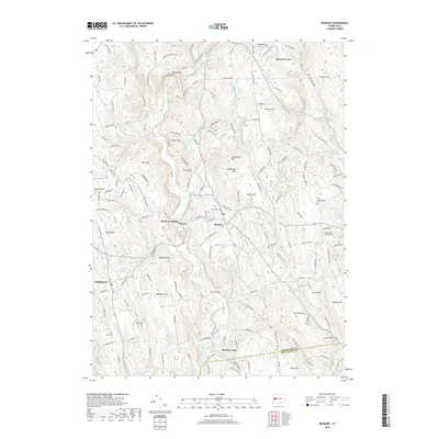
2018 Map of Roxbury
USGS Topo · Published 2018About this map
The Shepaug River carves a deep valley through this Litchfield County landscape, anchoring a series of historic settlements including Roxbury, Paquabaug, and Roxbury Station. This 2018 survey detail shows a classic New England pattern of upland farms and valley-floor centers, with names like Mine Hill and Sentry Hill rising above the winding river. The area is defined by its topographic complexity, where numerous small tributaries like Battle Swamp Brook and Moosehorn Brook feed into the primary waterway. Local history is well-preserved through numerous burial grounds, such as Center Cem and Old Leavenworth Cem, which are situated near established crossroads. The map also documents the transition from early industry and mining sites to modern land uses, including the Good Hill Farm Airport and preserved natural areas like Steep Rock and Raven Rock, which remain prominent landmarks in the Litchfield hills.
Find a feature on this map
158 named features on this map. Tap any name to fly to it.
Don’t see what you’re looking for? This feature index may not catch every label — zoom into the map to look around manually.
Map Details
Editions of this 2018 Roxbury Map
This is the sole edition of this map. No revisions or reprints were ever made.
Other maps of this area

1889 · Derby
USGS Topo · 1:62,500

1891 · Derby
USGS Topo · 1:62,500

1892 · Danbury
USGS Topo · 1:62,500

1892 · New Milford
USGS Topo · 1:62,500

1893 · Waterbury
USGS Topo · 1:62,500

1893 · New Milford
USGS Topo · 1:62,500

1893 · Derby
USGS Topo · 1:62,500

1904 · New Milford
USGS Topo · 1:62,500

1904 · Waterbury
USGS Topo · 1:62,500

1904 · Litchfield
USGS Topo · 1:125,000