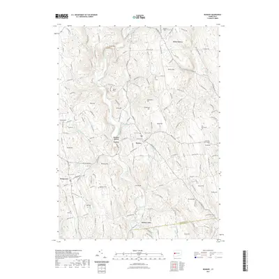
2021 Map of Roxbury
USGS Topo · Published 2021About this map
The Shepaug River carves a winding course through this Litchfield County landscape, anchoring a series of historic settlements including Roxbury, Paquabaug, and Roxbury Station. The terrain is defined by dramatic elevations such as Steep Rock and the curiously named Horse Heaven, while the industrial past is etched into the land at Mine Hill. In the southern portion of the quadrangle, the river drops through Roxbury Falls, a focal point near the border with New Haven County. Local heritage is well-preserved through several burial grounds, including Old Leavonworth Cem and Center Cem, alongside the Roxbury Church. The transition from traditional agriculture to modern aviation is visible at Good Hill Farm-Airport, while numerous brooks like Battle Swamp Brook and Moosehorn Brook feed into the primary river valley, illustrating the complex drainage patterns of this upland region.
Find a feature on this map
160 named features on this map. Tap any name to fly to it.
Don’t see what you’re looking for? This feature index may not catch every label — zoom into the map to look around manually.
Map Details
Editions of this 2021 Roxbury Map
This is the sole edition of this map. No revisions or reprints were ever made.
Other maps of this area

1889 · Derby
USGS Topo · 1:62,500

1891 · Derby
USGS Topo · 1:62,500

1892 · Danbury
USGS Topo · 1:62,500

1892 · New Milford
USGS Topo · 1:62,500

1893 · Waterbury
USGS Topo · 1:62,500

1893 · New Milford
USGS Topo · 1:62,500

1893 · Derby
USGS Topo · 1:62,500

1904 · New Milford
USGS Topo · 1:62,500

1904 · Waterbury
USGS Topo · 1:62,500

1904 · Litchfield
USGS Topo · 1:125,000