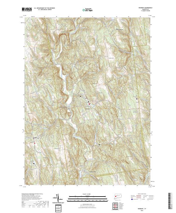
2024 Map of Roxbury
USGS Topo · Published 2024About this map
The Shepaug River carves a winding path through this corner of Litchfield County, anchoring a landscape defined by significant elevation changes and historic hamlets. In the village of Roxbury, the convergence of Roxbury Brook and Kirby Brook sits below a cluster of civic and spiritual sites, including North Cem and Saint Patrick Cem. The topography is marked by several named summits such as Mine Hill and Sentry Hill, while the settlement at Roxbury Station and the neighboring Paquabaug reflect the area's development along the river valley. To the south, the village of Bridgewater stands near Bulkeley Hill, overlooking a network of country roads and local water bodies like Hop Brook. Genealogists will find a high density of burial grounds throughout the quadrangle, ranging from the Old Leavenworth Cem in the northeast to the Old South Cem near the riverbanks below Roxbury Falls.
Find a feature on this map
175 named features on this map. Tap any name to fly to it.
Don’t see what you’re looking for? This feature index may not catch every label — zoom into the map to look around manually.
Map Details
Editions of this 2024 Roxbury Map
This is the sole edition of this map. No revisions or reprints were ever made.
Other maps of this area

1889 · Derby
USGS Topo · 1:62,500

1891 · Derby
USGS Topo · 1:62,500

1892 · Danbury
USGS Topo · 1:62,500

1892 · New Milford
USGS Topo · 1:62,500

1893 · Waterbury
USGS Topo · 1:62,500

1893 · New Milford
USGS Topo · 1:62,500

1893 · Derby
USGS Topo · 1:62,500

1904 · New Milford
USGS Topo · 1:62,500

1904 · Waterbury
USGS Topo · 1:62,500

1904 · Litchfield
USGS Topo · 1:125,000