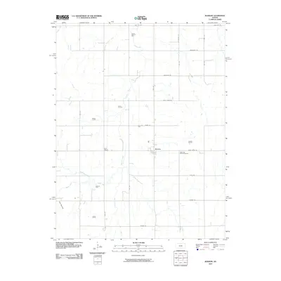
2010 Map of Roxbury
USGS Topo · Published 2010About this map
Roxbury serves as the central hub of this McPherson County landscape, situated at the confluence of several local oil operations. The map documents an extensive network of petroleum extraction, including the Roxbury Oil Field, Gypsum Creek Oil Field, and Crowther Oil Field, illustrating the region's significant economic reliance on energy resources. The terrain is defined by the branching tributaries of Gypsum Creek, which wind through a grid of rural roads like Smoky Valley Rd and Wells Fargo Rd. Genealogy researchers can locate burial sites at Eureka Cemetery and Valley View Memorial Cemetery, while the distinctive topography of Twin Mounds stands out in the southwest corner. The transition from the North Gypsum Creek to the South Gypsum Creek captures the essential hydrology of this agricultural and industrial prairie.
Find a feature on this map
35 named features on this map. Tap any name to fly to it.
Don’t see what you’re looking for? This feature index may not catch every label — zoom into the map to look around manually.
Map Details
Editions of this 2010 Roxbury Map
This is the sole edition of this map. No revisions or reprints were ever made.
Other maps of this area

1889 · Newton
USGS Topo · 1:125,000

1889 · Abilene
USGS Topo · 1:125,000

1891 · Hutchinson
USGS Topo · 1:125,000

1892 · Salina
USGS Topo · 1:125,000

1893 · Hutchinson
USGS Topo · 1:125,000

1894 · Newton
USGS Topo · 1:125,000

1894 · Abilene
USGS Topo · 1:125,000

1942 · Salina
USGS Topo · 1:125,000

1955 · Assaria
USGS Topo · 1:24,000

1955 · Gypsum
USGS Topo · 1:24,000