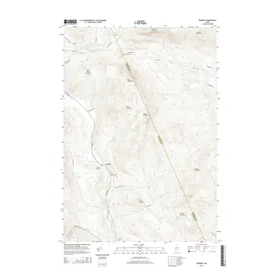
2014 Map of Roxbury
USGS Topo · Published 2014About this map
Roxbury and its surrounding mountain peaks define this section of the Franklin and Oxford county line in western Maine. The settlement is centered along Roxbury Rd and the Swift River, serving as a focal point for a region characterized by steep ridgelines and narrow valleys. For genealogists, the map identifies three distinct burial sites: Roxbury Village Cem, Shaw Cem, and Pineview Cem. The presence of the Thomas Airport north of the village indicates a modern layer of infrastructure amidst the traditional landscape of peaks like West Mountain and Tumbledown Mountain.
Find a feature on this map
54 named features on this map. Tap any name to fly to it.
Don’t see what you’re looking for? This feature index may not catch every label — zoom into the map to look around manually.
Map Details
Editions of this 2014 Roxbury Map
This is the sole edition of this map. No revisions or reprints were ever made.
Other maps of this area

1926 · Dixfield
USGS Topo · 1:62,500

1927 · Rumford
USGS Topo · 1:48,000

1929 · Phillips
USGS Topo · 1:48,000

1929 · Dixfield
USGS Topo · 1:62,500

1930 · Rumford
USGS Topo · 1:62,500

1932 · Phillips
USGS Topo · 1:62,500

1933 · Rangeley
USGS Topo · 1:48,000

1939 · Rangeley
USGS Topo · 1:62,500

1949 · Rangeley
USGS Topo · 1:62,500

1950 · Lewiston
USGS Topo · 1:250,000