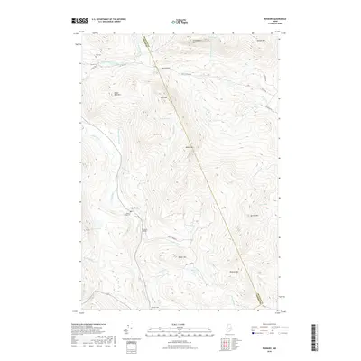
2018 Map of Roxbury
USGS Topo · Published 2018About this map
Roxbury serves as the primary settlement on this modern topographic study, situated along the banks of the Swift River in the heart of Maine's western mountains. The landscape is defined by its significant relief, featuring numerous named peaks such as Whale Back Mtn. and Jackson Mtn. Historical and genealogical markers are well-preserved, including the Roxbury Village Cem near the town center, and the remote Shaw Cem and Pineview Cem. The boundary between Oxford and Franklin Counties cuts diagonally through the terrain, highlighting the region's geopolitical layout. Small-scale infrastructure like Thomas Airport and the winding Weld to Byron Rd illustrate the local transportation network through high-elevation passes like Byron Notch. Natural water bodies, from the high-altitude Tumbledown Pond to the secluded Bunker Pond, dot the drainages of the East Branch Swift River and its various mountain brooks.
Find a feature on this map
45 named features on this map. Tap any name to fly to it.
Don’t see what you’re looking for? This feature index may not catch every label — zoom into the map to look around manually.
Map Details
Editions of this 2018 Roxbury Map
This is the sole edition of this map. No revisions or reprints were ever made.
Other maps of this area

1926 · Dixfield
USGS Topo · 1:62,500

1927 · Rumford
USGS Topo · 1:48,000

1929 · Phillips
USGS Topo · 1:48,000

1929 · Dixfield
USGS Topo · 1:62,500

1930 · Rumford
USGS Topo · 1:62,500

1932 · Phillips
USGS Topo · 1:62,500

1933 · Rangeley
USGS Topo · 1:48,000

1939 · Rangeley
USGS Topo · 1:62,500

1949 · Rangeley
USGS Topo · 1:62,500

1950 · Lewiston
USGS Topo · 1:250,000